If you don't want to read my report, you can grab a refreshing cold drink of your choice, kick back, and enjoy Sarge's Wabakimi Video. THANKS, SARGE!
Duration: August 3, 2011 – August 13, 2011
Duration: August 3, 2011 – August 13, 2011
Trip Totals: 97km traveled
13 portages, total portage distance 2482m
Entry Point: South tip of Little Caribou Lake 50.338778, -89.088650
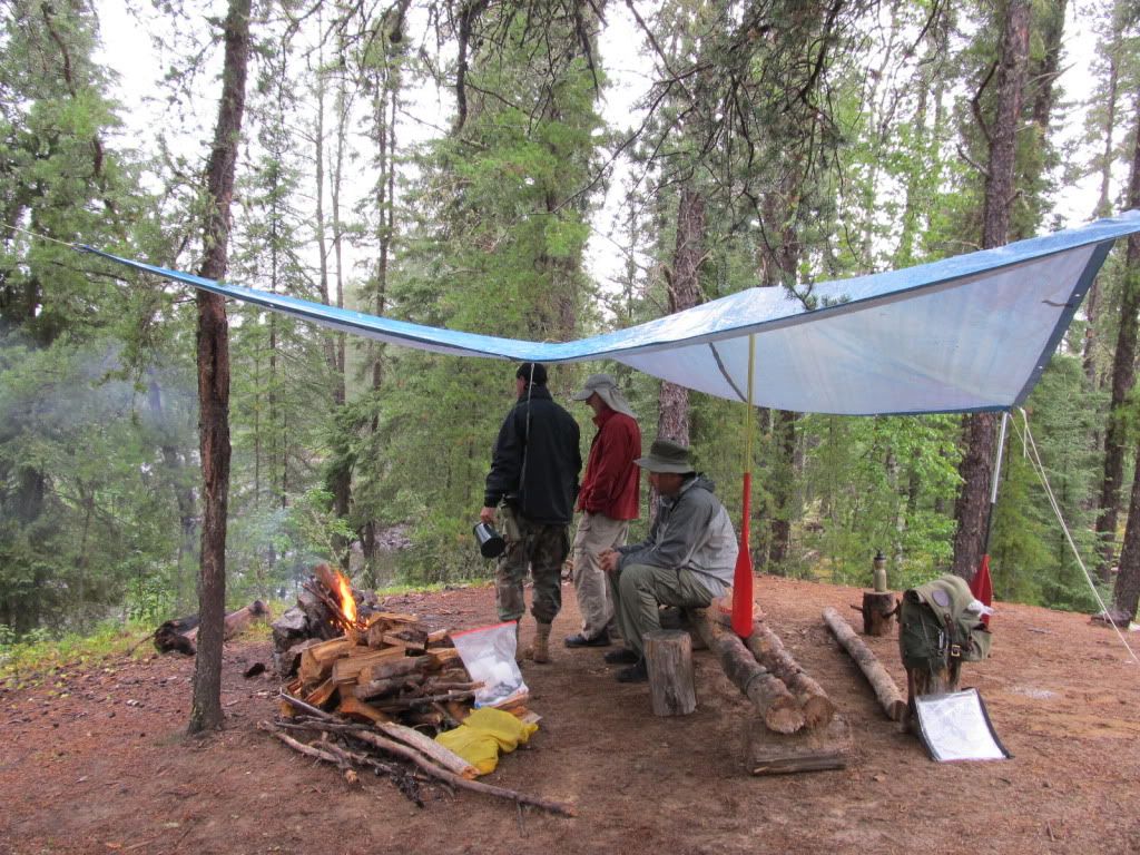
Aug. 2 Pete came over and we packed up the food. Pete brought over the Seal A Meal and we all had great fun compacting noodles, pancake mix, tomato sauce, powdered milk, etc. We put the butter into my trusty food tubes. We packed up the oatmeal and tea, koolaid-type stuff, and granola. (Ya gotta have granola!) A beer or four and we were all done with that chore!
Aug. 3 - I worked until about noon on 8/3 when Pete came by and we started to pack up the gear.
The phone kept me busy while I was trying to finish packing and, of course, I forgot some of the food in my fridge. At about 2, we had the packs in the car and took off to pick up Pat at the airport. No trouble there and we were officially on the road by 3:15p.m.
We got to Superior, WI around 10p.m., checked into our room and went to get liquor and a few items that I had left at home, e.g. tortillas, cheese, beef jerky…
Aug. 4 – Up at 7 and on the road by 7:45. Grabbed coffee and a bite and headed up the beautiful north shore of Lake Superior. What a view! Got to the border at 11:30 CDT [12:30 EDT, all times are EDT until further notice…I’ll explain…] We had to sit while they checked to see if we were natural born killers, or just good guys. Pat was in the Army so his passport has stamps from Kuwait, Iraq, Germany, Egypt, and more. After a while they came out and asled “What states have you lived in?” Me: Illinois, Pete: Illinois, Pat: Illinois, Wisconsin, Florida, Alabama, Arkansas, Arizona…I jumped in here and said “All courtesy of the US Army.” That is what they were actually looking for and we were cleared for entry.
There was a guy busted for trying to bring pot into Canada. An older guy, with 20-somethings had a Dodge Durango filled with gear. They were directed to the long steel tables. Once the pot was discovered, every single piece of gear and clothing was dumped and thoroughly searched. The older guy and two of the younger guys were just starting to put it all back in the truck as we drove away. We guessed their trip was a bust!
1:15 and Thunder Bay bound. After lunch we headed east, turned north, and were completely out of town and haulin’ a** to Armstrong. 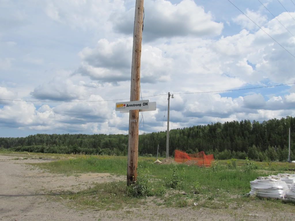
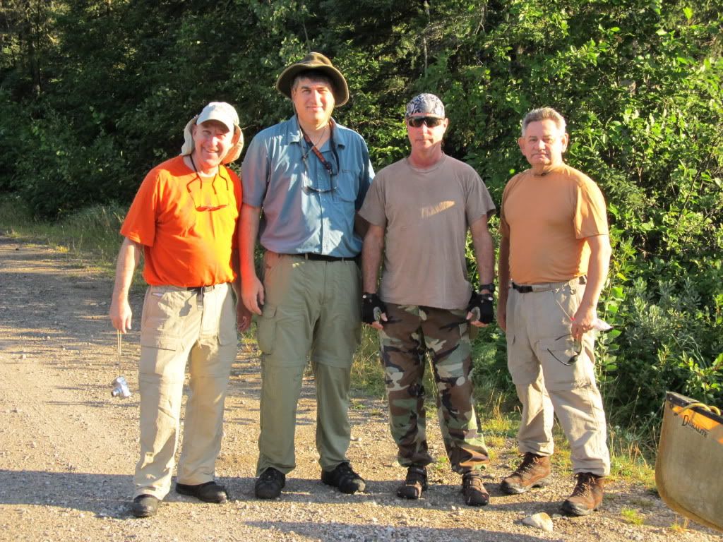
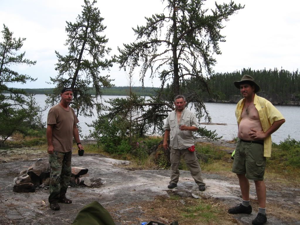
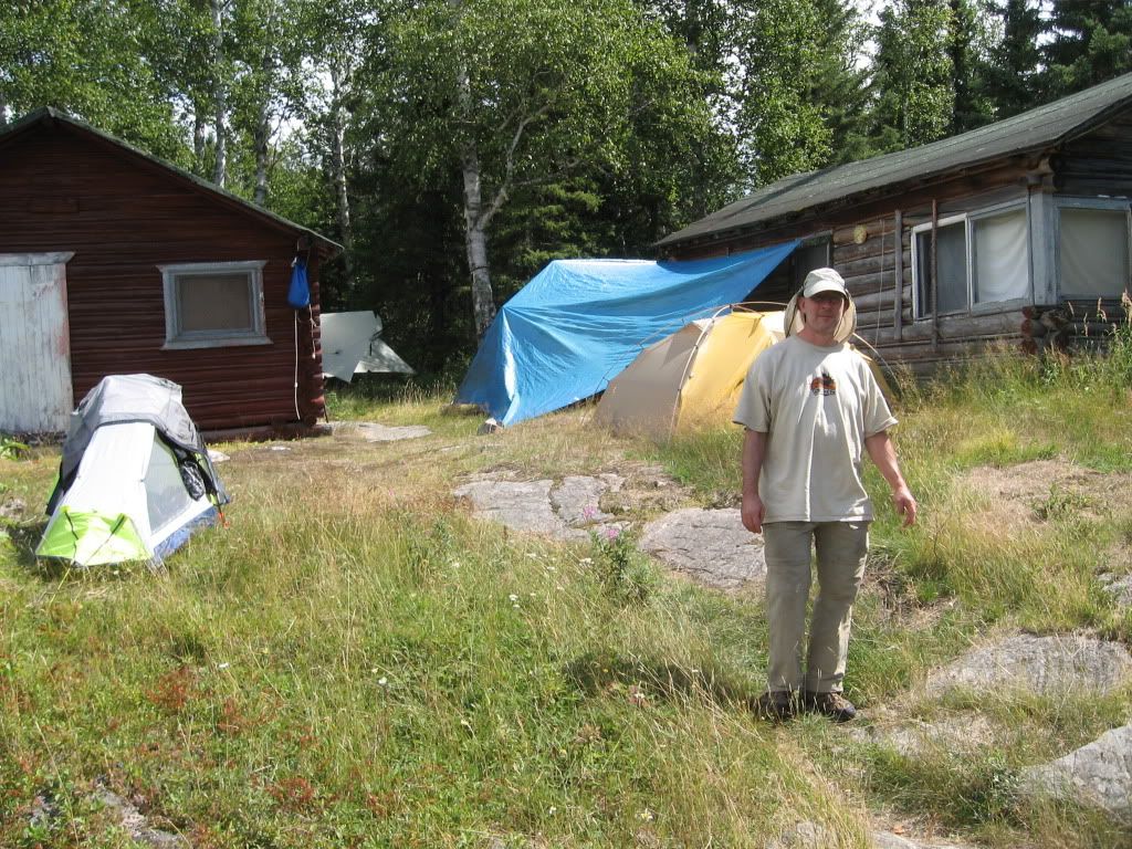
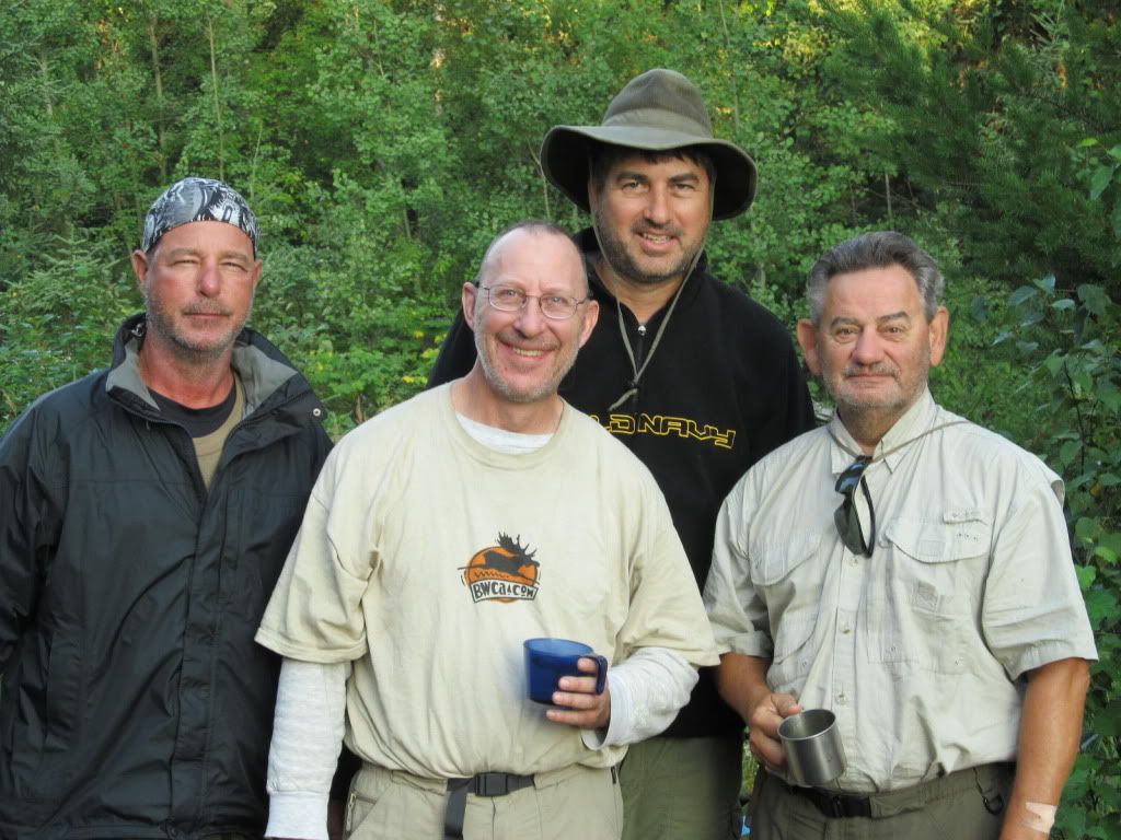
Arrived at Wildwaters about 4:15. (Thunder Bay to Wildwaters in about 2.25 hours) We knew Dave was already there because there was his canoe proudly displaying the Flying Moose(BWCA.com), waiting for us on the front lawn of the outfitter. We dumped our gear, met Dave, and then had to decide whether we would go through Funger Lake as planned, or re-route south of the park and take a shorter trip. There was a forest fire burning on the north shore of Funger. Burt said it was still pretty small, but he wanted to give us options. We talked it over for about 2 minutes. We didn’t want to shorten our trip and we were there for adventure, so we all decided to go the original route.
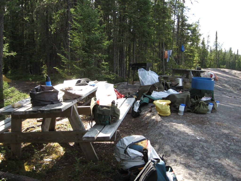
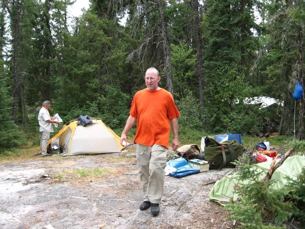
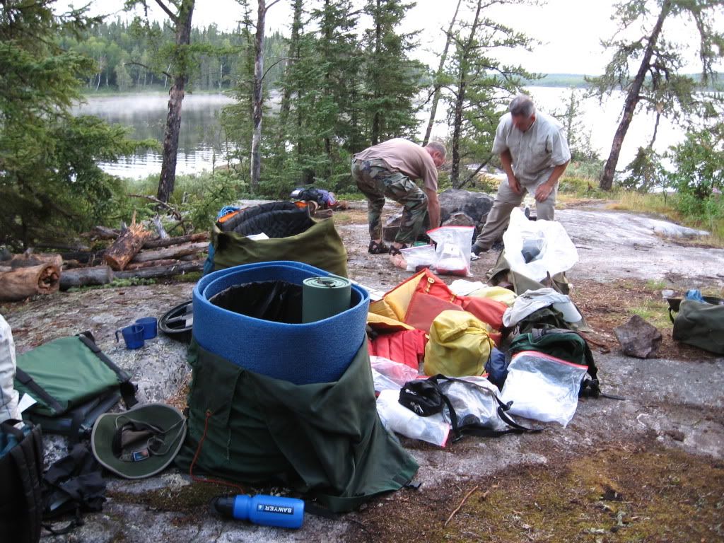
We went through the maps and trip notes with Burt and then went to town and had dinner and then re-packed all our gear to mix and match my stuff with Dave’s. We probably had enough gear to outfit another 2 guys and then some, so a lot of stuff was left in the cars. We sat up and chatted with the Burt, Brenda, and their summer intern, Rebecca, until 10:30 or so and then went off to bed.
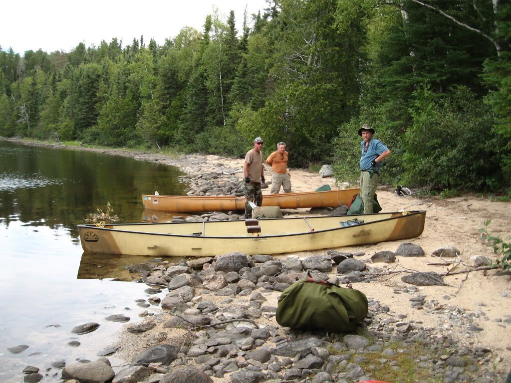
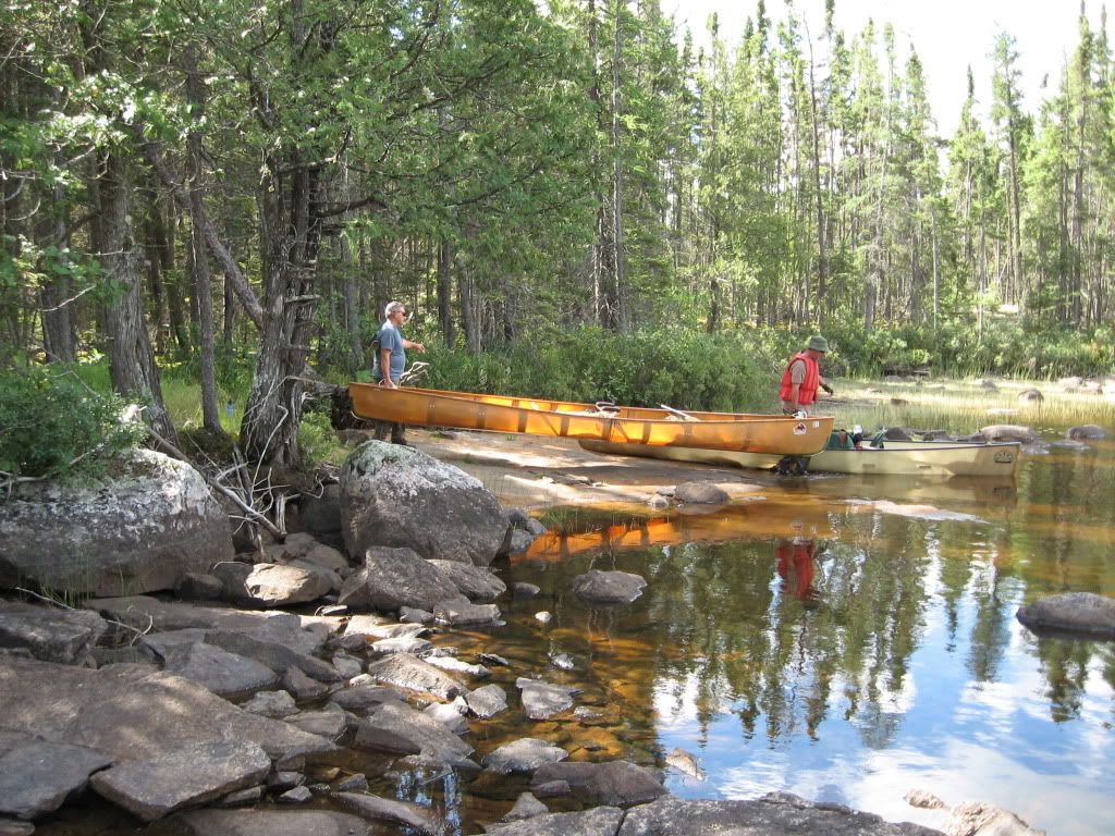
Aug. 5- Up around 6 and fidgeted until breakfast was done, say 8:00 or so. Then we loaded Burt’s truck at he took us to the put in at the bridge.
We were finally in the water at 8:30a.m.! 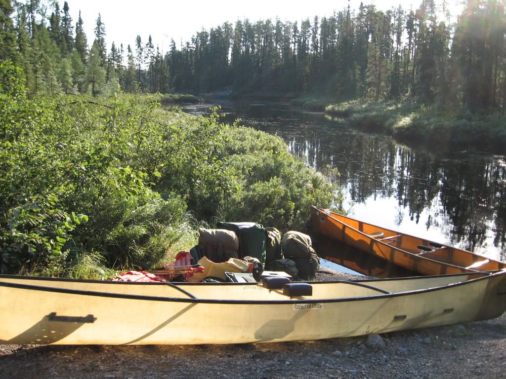
Day 1 – Little Caribou Lake, across Caribou Lake, up the Caribou River
23.3 km travelled
Portages: 1: 260m
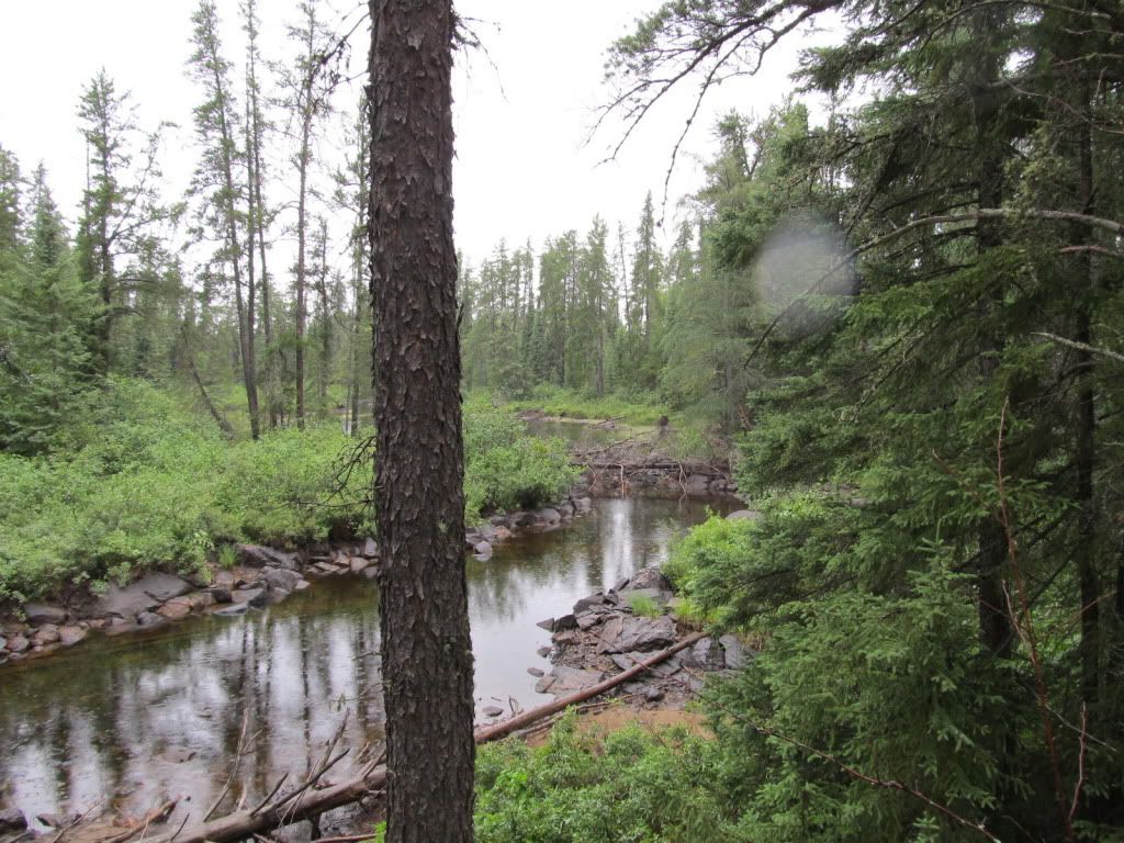
Campsite Night One - Island site in the Caribou River - 50.516046, -89.166412.
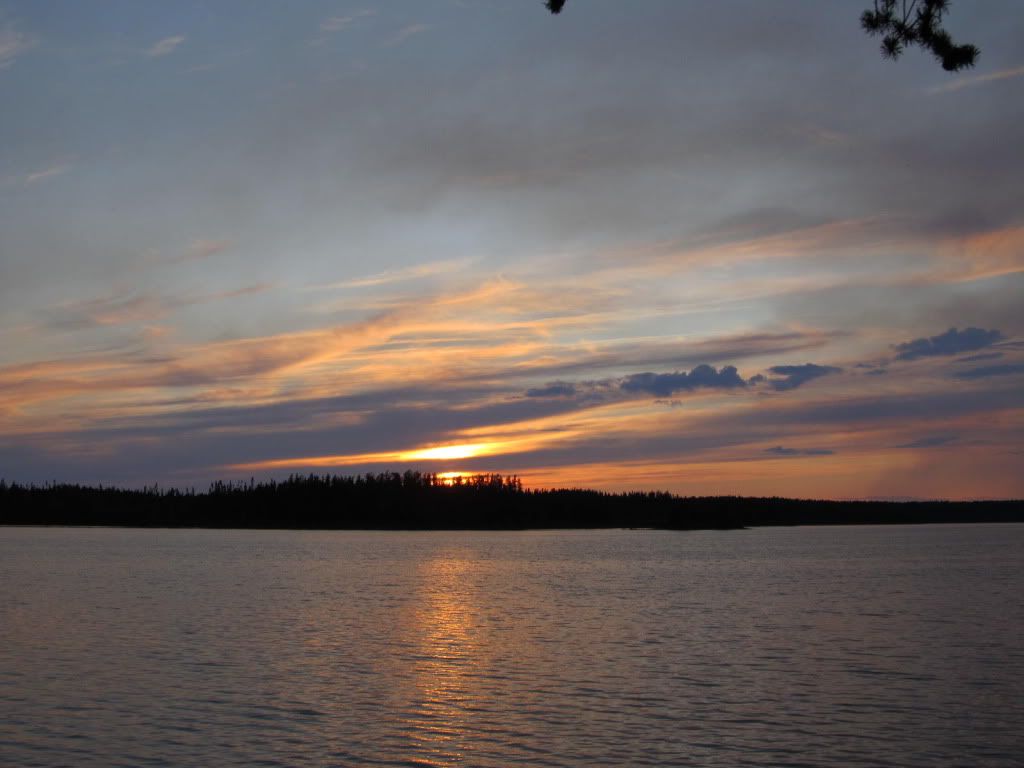
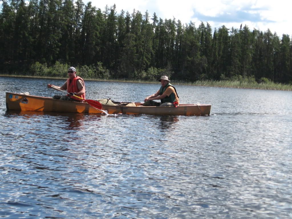
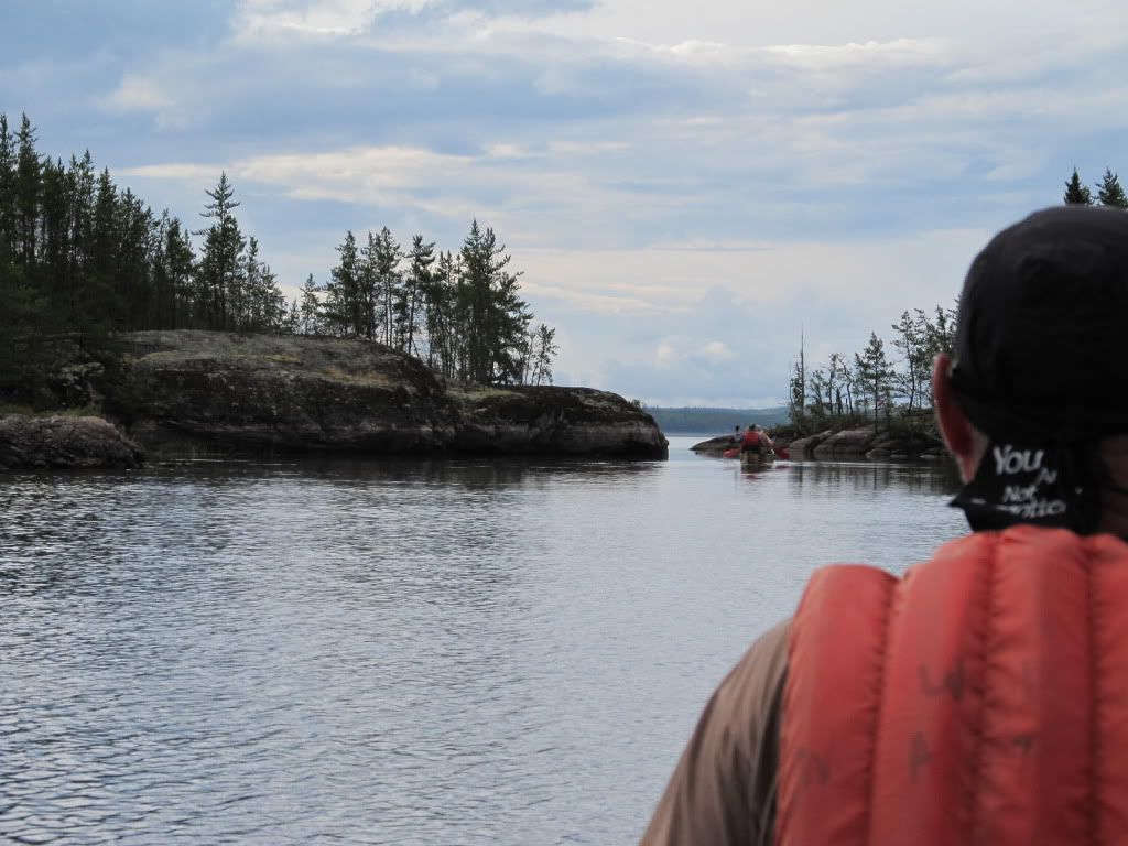
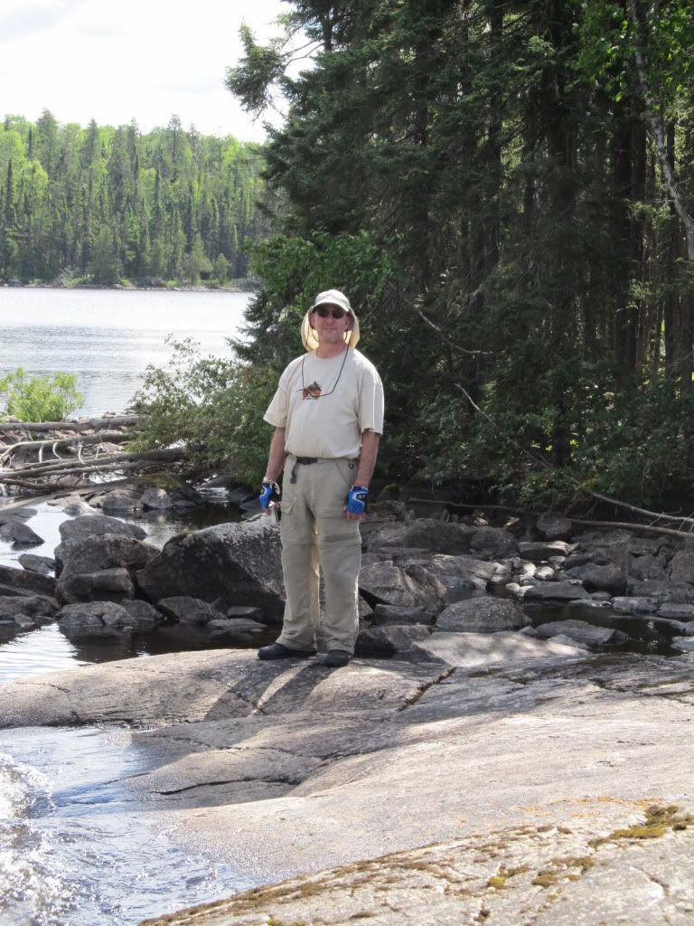
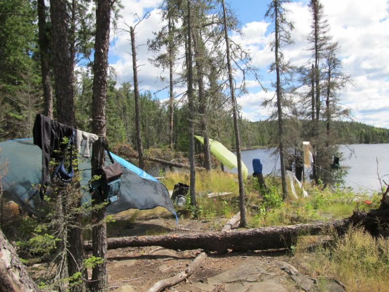
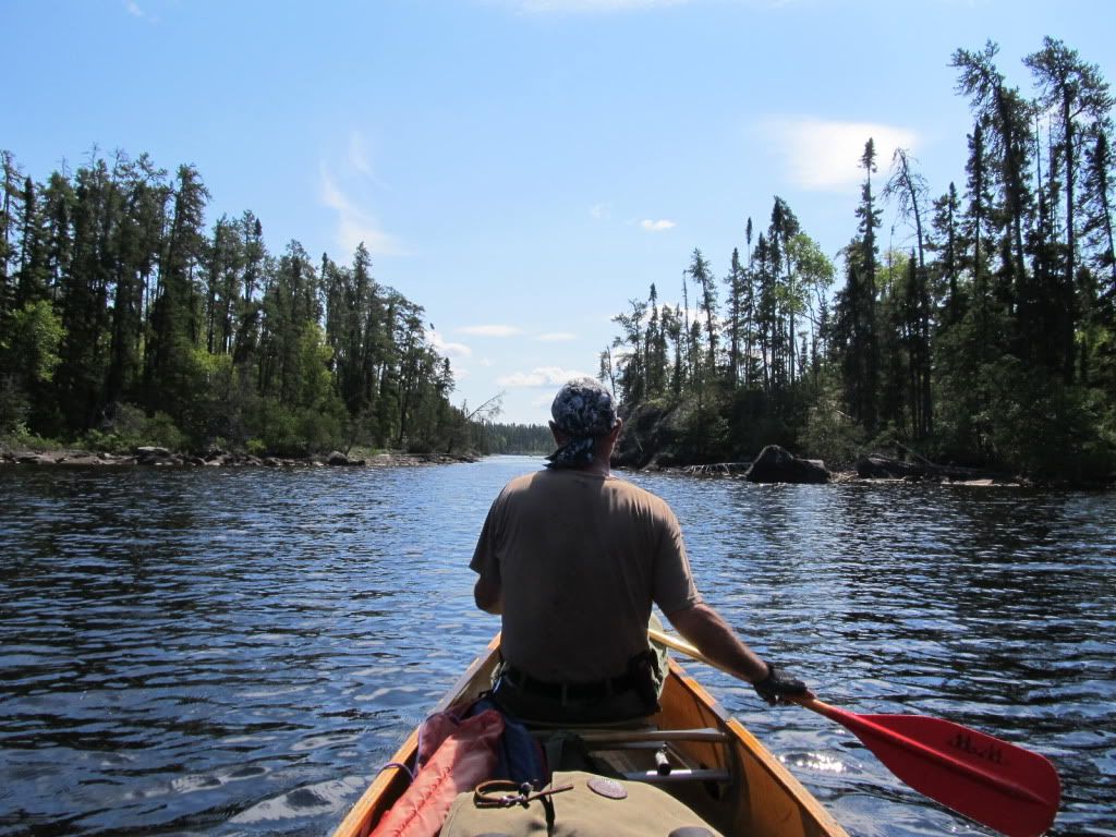
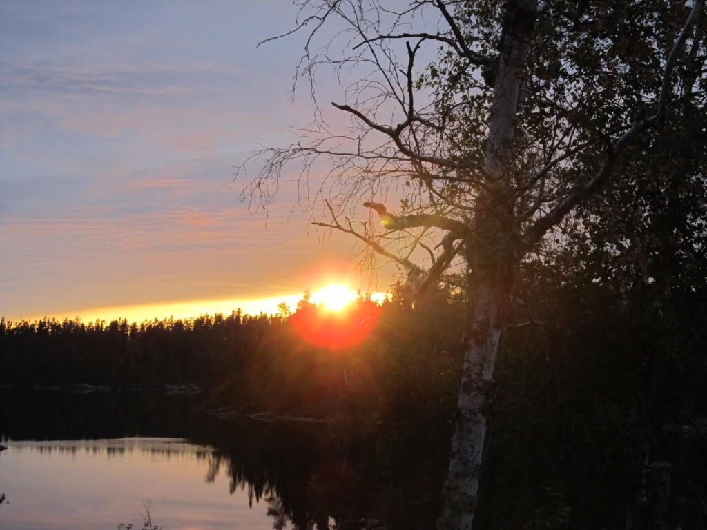
Put In: 50.338778, -89.088650 (south tip Little Caribou Lake) It was a beautiful, sunny morning as we made that first dip of paddle to water. Excellent conditions in which to begin our Wabakimi sojourn. We paddled up Little Caribou Lake as some light clouds floated overhead. The lake is a narrow one and the wind was mild. Sweeps and I spotted a bald eagle about half way up the lake. We made the 11km before lunch. A short portage into Caribou Lake and we were on our first big water of the trip. We saw a broken down old cabin as we crossed the portage. 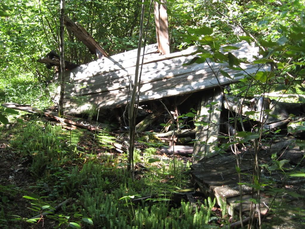 The wind was coming up as we headed west toward the park. We decided to head south of Beaver Island to save several km of paddling. The wind was from the southwest and we were getting some pretty significant windblown waves across the left front quarter. It always makes me a little nervous being out in the middle, paddling against a decent chop, with a fully loaded canoe. But the Souris River Quetico 17 and Dave’s MNII are both sturdy, stable craft and we were across the 8km of big water just about the time we noticed the sun was on its way to the west. We entered the Caribou River and discussed where we wanted to camp. Dave suggested we push on about five km to the little island site on the map. I thought it was pretty late, but we voted to keep going. I was wrong. The sun doesn’t set up here until quite late, close to 10pm, and we had plenty of time to make a few km, set camp, and get a fire going for dinner. We had camp set and dinner cooking by 8pm.
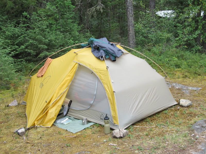
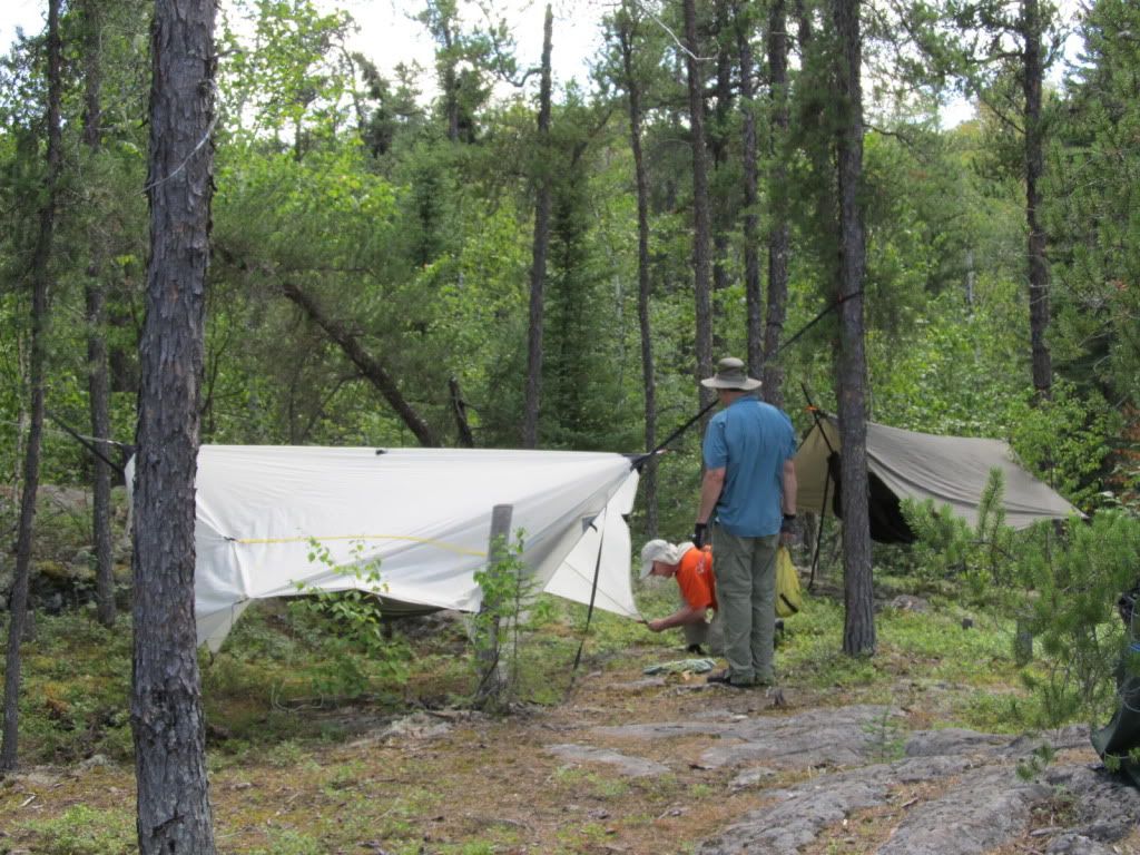 |
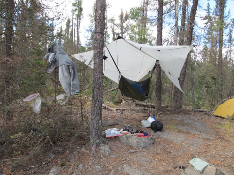
| Pete's hammock set-up and mine in the back |
 |
| Sarge setting up his little 1 man |
Good thing Dave brought his grill since I forgot mine in our rush to leave Chicago. [Note to self: DON’T WORK ON THE DEPARTURE DAY!] Filet mignon and corn on the cob for dinner. 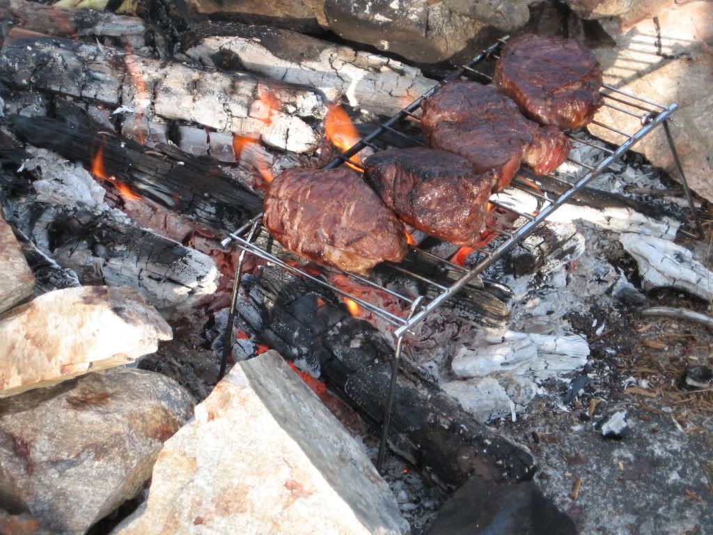 A nice night cap, and off to bed just as the sun was setting.
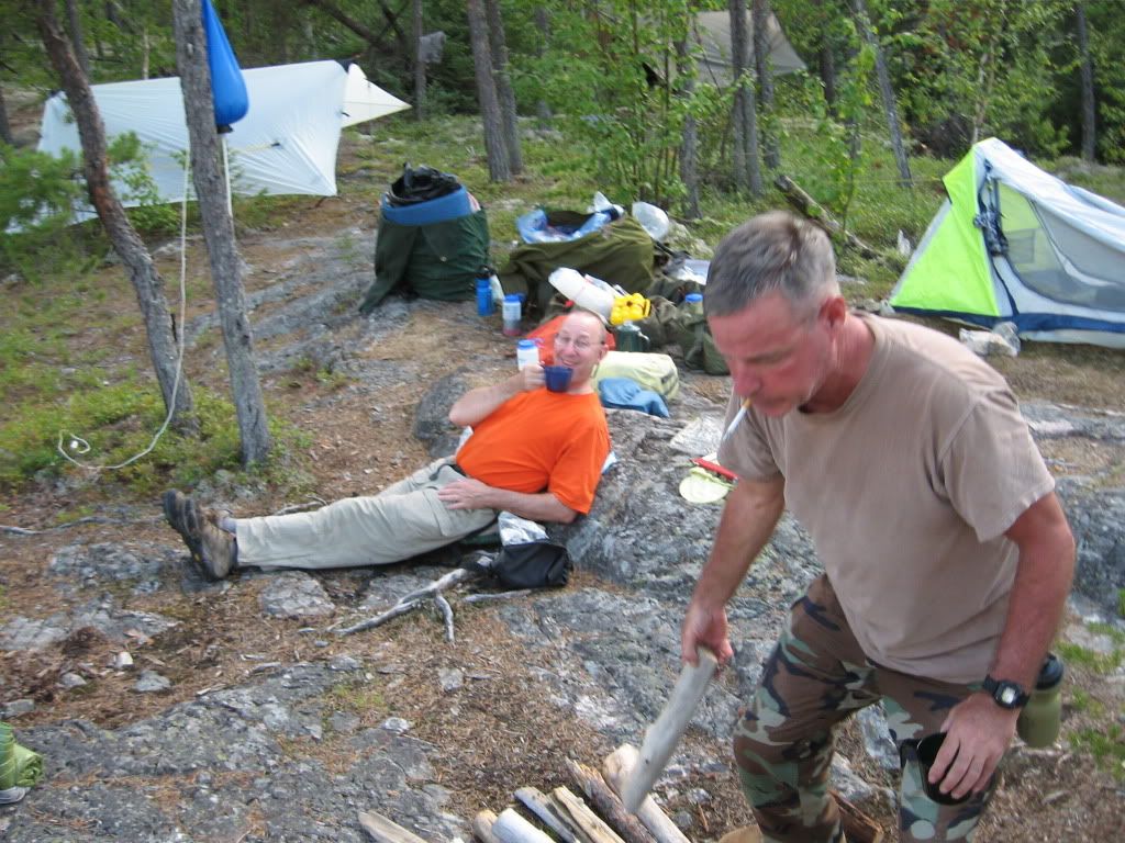 |
| I enjoy a delightful Wabakimi Punch Cocktail |
No mossys. That surprised us all. Once I was in the hammock, and the sun was down, the mossys came out in force. We could hear the little vampires buzzing outside the net just dying for a little taste of our vital bodily fluids!
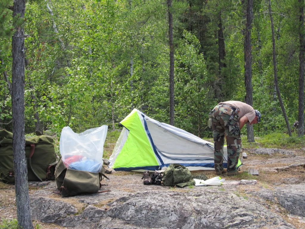
 |
| dl's single wall tent |
Day 2 – Caribou River into Funger Lake then into Caribou Bay
16.3 km travelled Portages: 4: 100m, 80m, 100m, 80m
Campsite Night Two - Penninsula site on Caribou Bay - 50.532744, -89.334126.
We awoke around 6:30 or so and took our time making hot tea and oatmeal for breakfast.
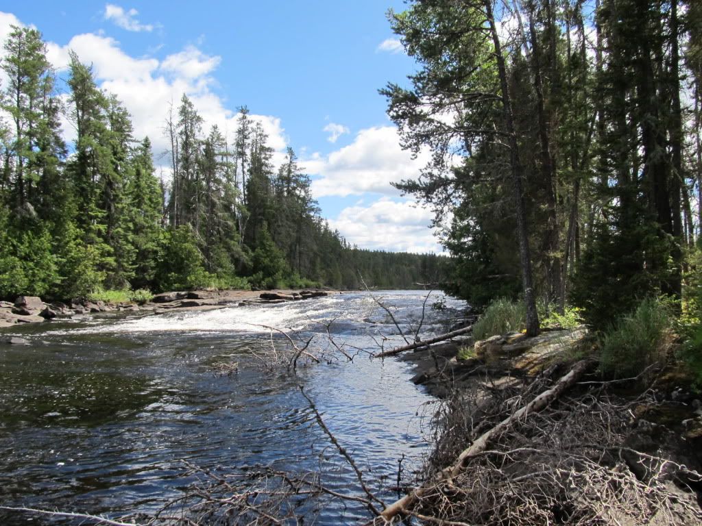
As we broke camp and headed down the Caribou River it seemed that we were getting some overcast. It was nice and warm, and we had a little wind, but nothing to be concerned about. We had several portages today. I have never canoed in a place with portages so close to the rapids. I was also worried that we would not be able to find the portages.
I had read in my research that the trailheads were very small and well hidden. I was afraid we might have some trouble being pulled down the rapids before we beach the boats and portage around.
 |
| dl and Sarge looking for a portage |
 |
| Standing at the portage looking at the rapids |
Well, we were OK. The portages were very close to the rapids, but we moved slowly and we found each portage with little difficulty.
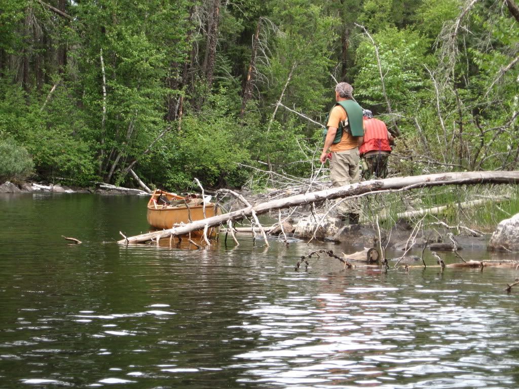
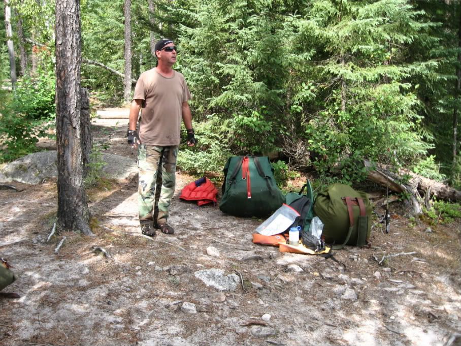
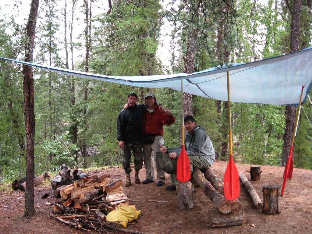
At the third portage of the day, we had to line the boats through a little channel just before the portage. This was a first for me. I had never lined a canoe as all my previous trips were in lakes. This trip we were doing a lot of drop and pool paddling. It was great fun and my new OTB boots handled it extremely well. As we were entering the water at the end of the third portage, the Sargeant Major crawled over the packs to reach the bow. As he put his weight on the yoke of Dave’s MNII it broke and also cracked the wood gunwale. Oh, man, we seemed to be in some real trouble. We stayed calm, though, and at the next portage we unloaded the boat and carried up to the campsite at the middle of the portage. Pat used some paracord to lash it all back together.
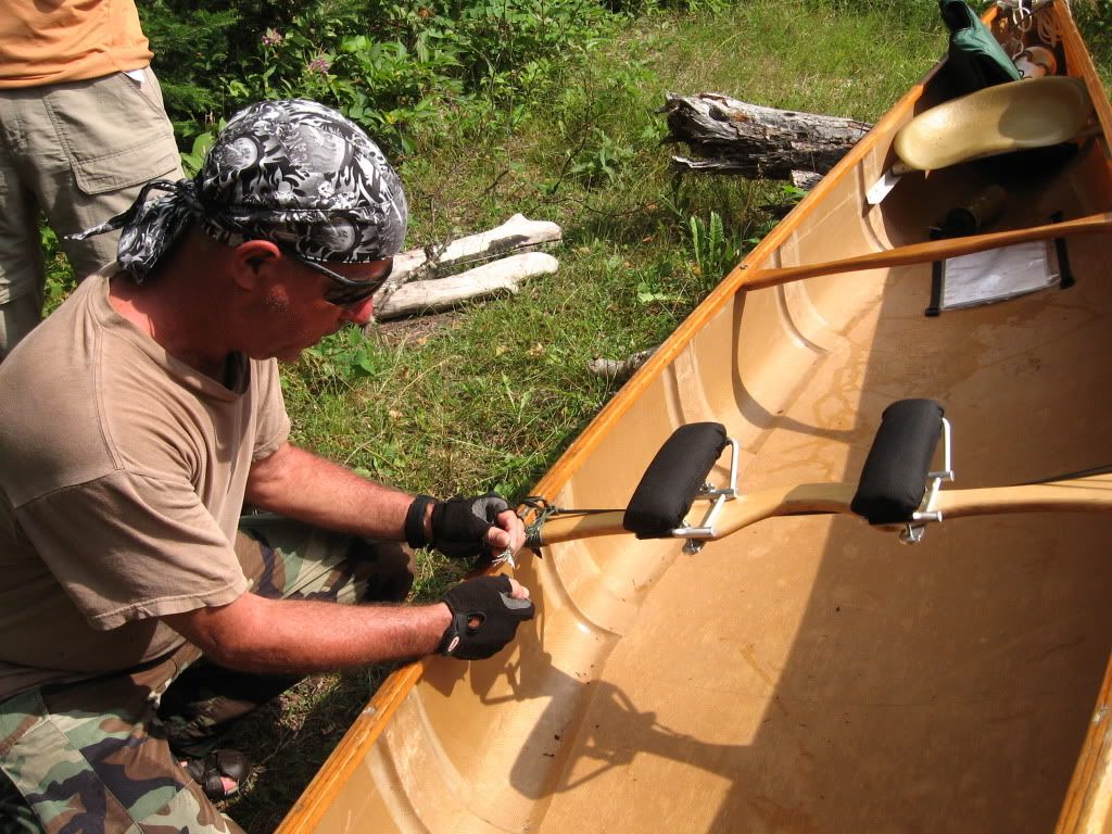
He had some “help” from Sweeps and Dave.
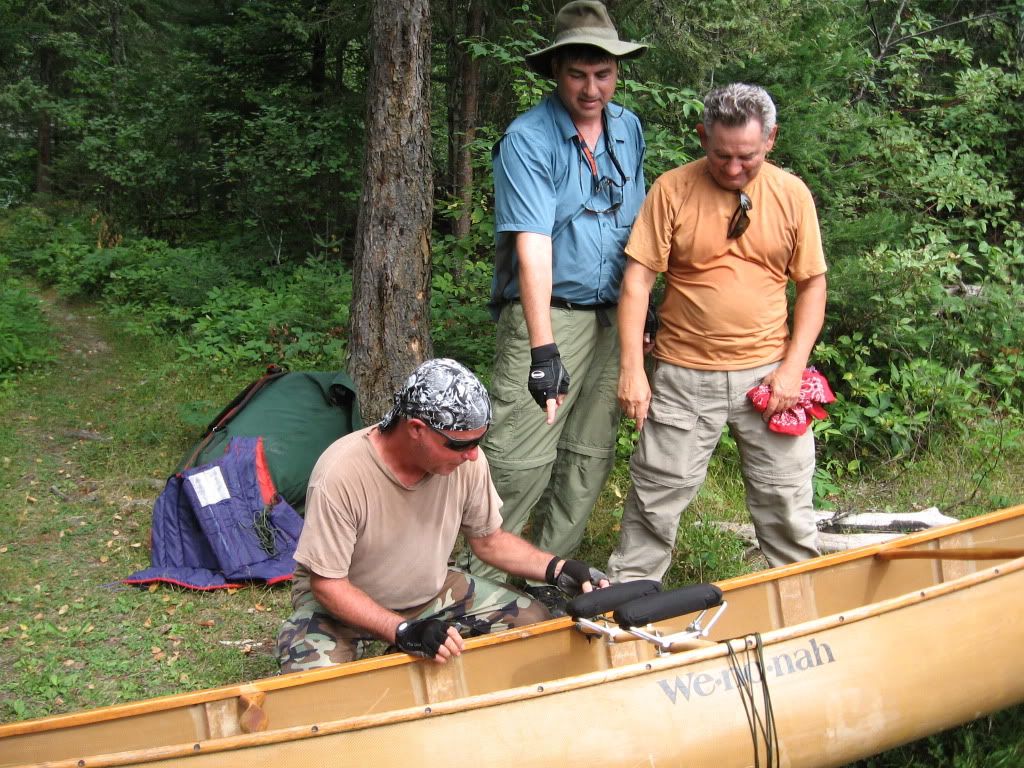 |
| "You missed a spot!" |
They gave it a little test and it seemed good to go. Fortunately, we did not have any portages for a few days, so we would be able to really test the lashing and fix any serious issues before we needed to carry the boat any significant distance.
We had a long lunch on the nice sandy beach at the east end of Funger Lake.
Well, westward ho! into Funger and let's see what nature has in store for us! 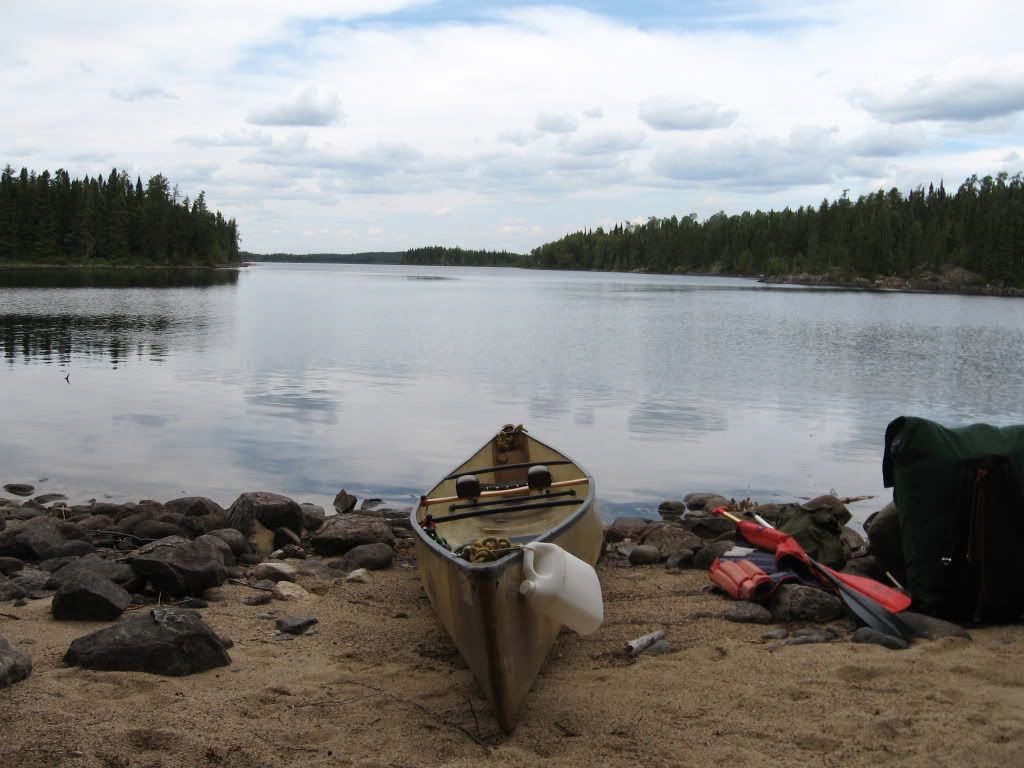
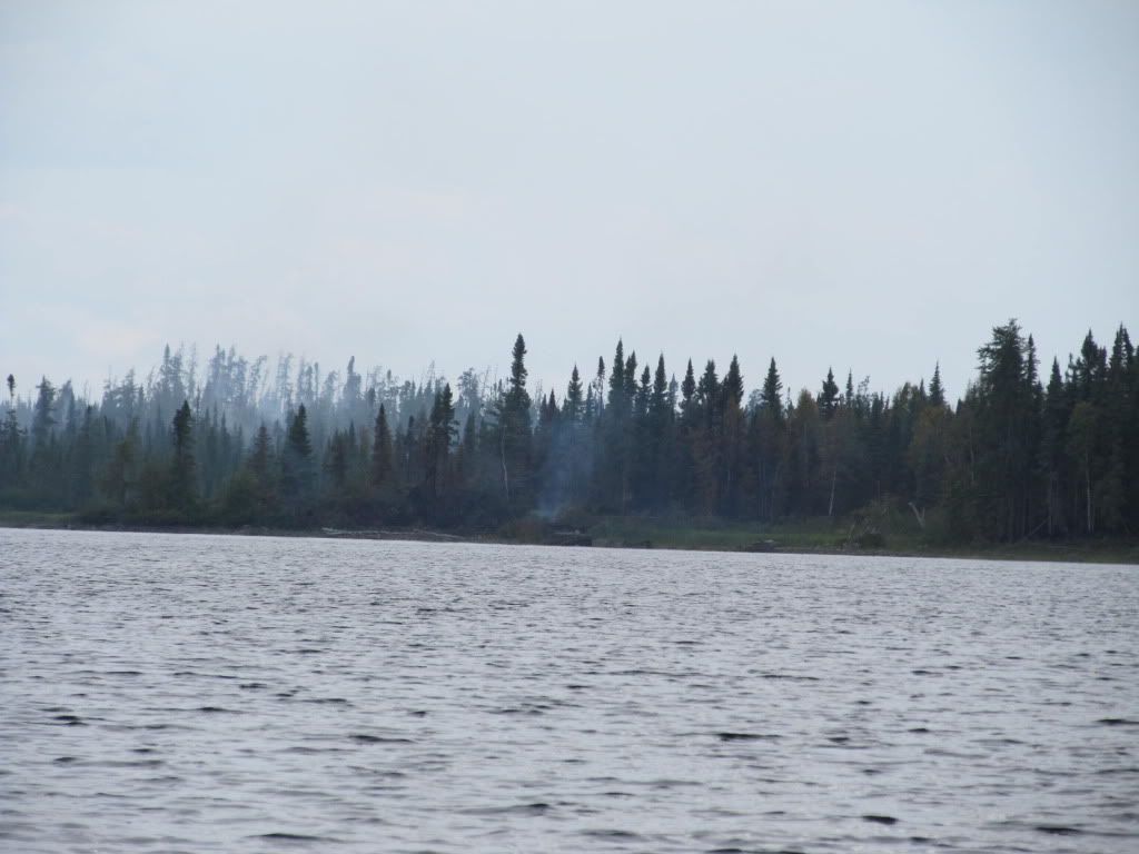
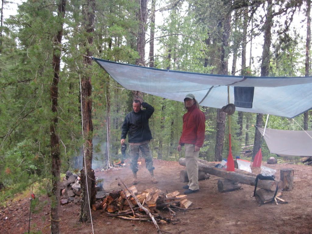
We could smell a fire getting closer by this time.
We were not sure how big the fire might be, the sky wasn’t black or anything like that. We could now smell the fire now, but it was not really very strong. We wondered if maybe it was going out or had blown on to another area. So we pushed on west through the center of Funger Lake. As we reached the narrows known as the “Honey Hole” on our maps, the fire was burning low and broad all along the northern shore.
Our eyes were now feeling the smoke. The wind seemed to be from the north or northeast, but there were no flames visible. I caught a couple 15-18” Northerns, but released them because we had been told that walleye were plentiful. Why eat Northern when we would soon be feasting on walleye?? Right??
By the time we entered Caribou Bay we were pretty tired. We decided to stop at the first campsite we found. We were about 3km past the Honey Hole and saw a site as marked on the map. Helicopters had been crisscrossing the park the whole time we had been there. Burt told us they were fighting the fires up in the north end of the park and were shuttling crews in and out by chopper. As we were heading toward the camp site, a helicopter which had been flying pretty high turned around and swooped down toward us. It circled pretty low over us and then flew back up and went north again. We were confused about that, but thought he was just making sure he knew how many were in our party.
We tried the campsite at 50* 33’ 25.0”N 89* 16’ 59.9”W. This was a pretty bad site. It had a very difficult landing with high rocks to throw the packs up and then we had to drag the canoes up about 5-6 feet. It had one poor tent pad and was on a windy, rocky point. We moved the fire pit out onto the exposed rock point to try and make another tent site. (We could not find any good hammock spots and so would need to use tents.) Just as we finished moving the fire pit we realized why the chopper pilot had come down and circled us. He was trying to warn us that a forest fire was blowing toward us from about 1-2 km away. We thought we had paddled past the fire, but on a second look we realized this just wasn't the place.
We set camp, and had spaghetti and sauce for dinner. Irish whiskey would cap this day off quite nicely. Beautiful views to the south and west as the sun set late. Again, no skeeters until we went to bed.
Once the sun had set we could see how much smoke there really was. 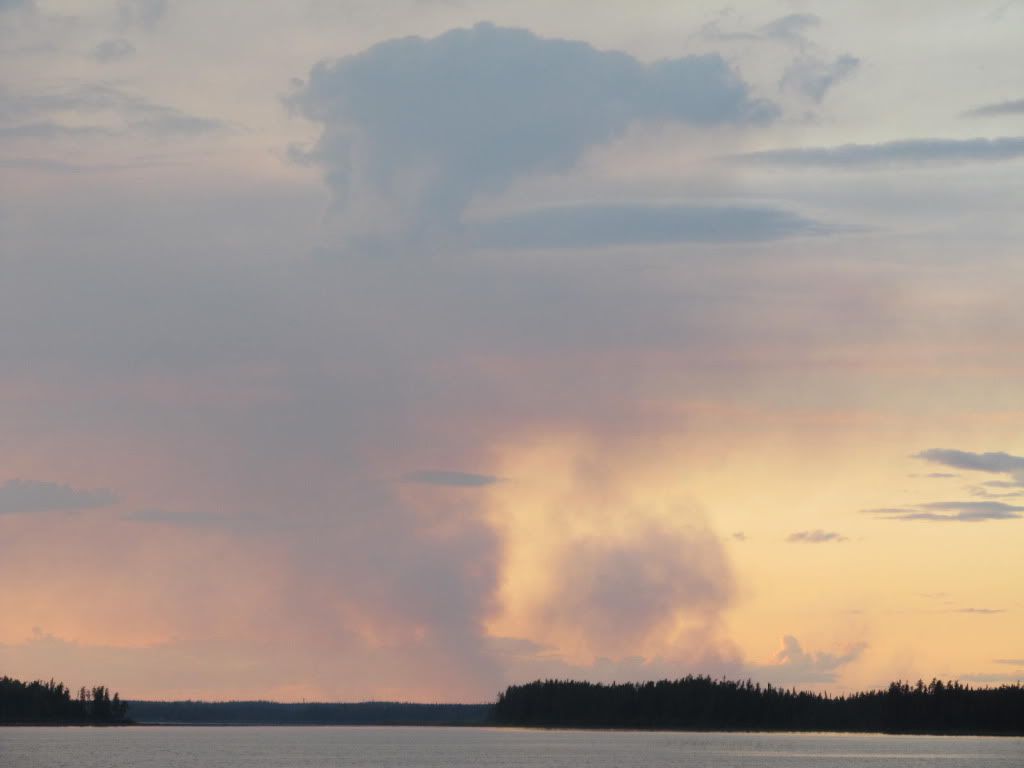

Day 3 – Through Caribou Bay across the north end of Smoothrock Lake to the “Super” campsite.
9.4 km travelled
Portages: None
Camp site Night Three – Super site - 50.575824, -89.435406
Up late today. It got quite chilly last night, but I was warm and toasty in my hammock and underqulit. We had fresh eggs and pre-cooked bacon for breakfast. We were going to take it easy today. Good weather again! Just look at that crystal clear sky!
 |
| We're gonna catch a LOAD of fish! |

We look over the maps before we set out and plan our day’s paddle.
We decided to just get into the top of Smoothrock Lake and stop for an early camp. We paddled up the rest of Caribou Bay and out into the main part of Smoothrock. We had worried that we might have issues with wind and waves as we crossed the main body of Smoothrock. But the water gods were with this day, my friend. The water was calm and the wind light.
We crossed the big water quickly and arrived at our goal for the day. We had paddled less than three hours, but since we went so far the first day we were still ahead of our original schedule. The camp site was marked “SUPER” on the Wildwaters map. It had three picnic tables, two propane burners, and three big 18” fry pans that the fly-in lodge had put there.
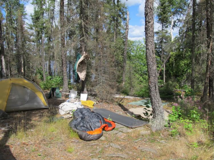
There were a lot of good tent pads and plenty of trees for the hammocks. We spread out over a huge area several hundred yards wide. 
Sweeps spreads his wings!Here is Pat’s one man tent. 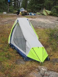
 I set up my hammock about 75 yards
 away from the main camp area.
I had a nice waterfront parcel looking
off to the northwest.
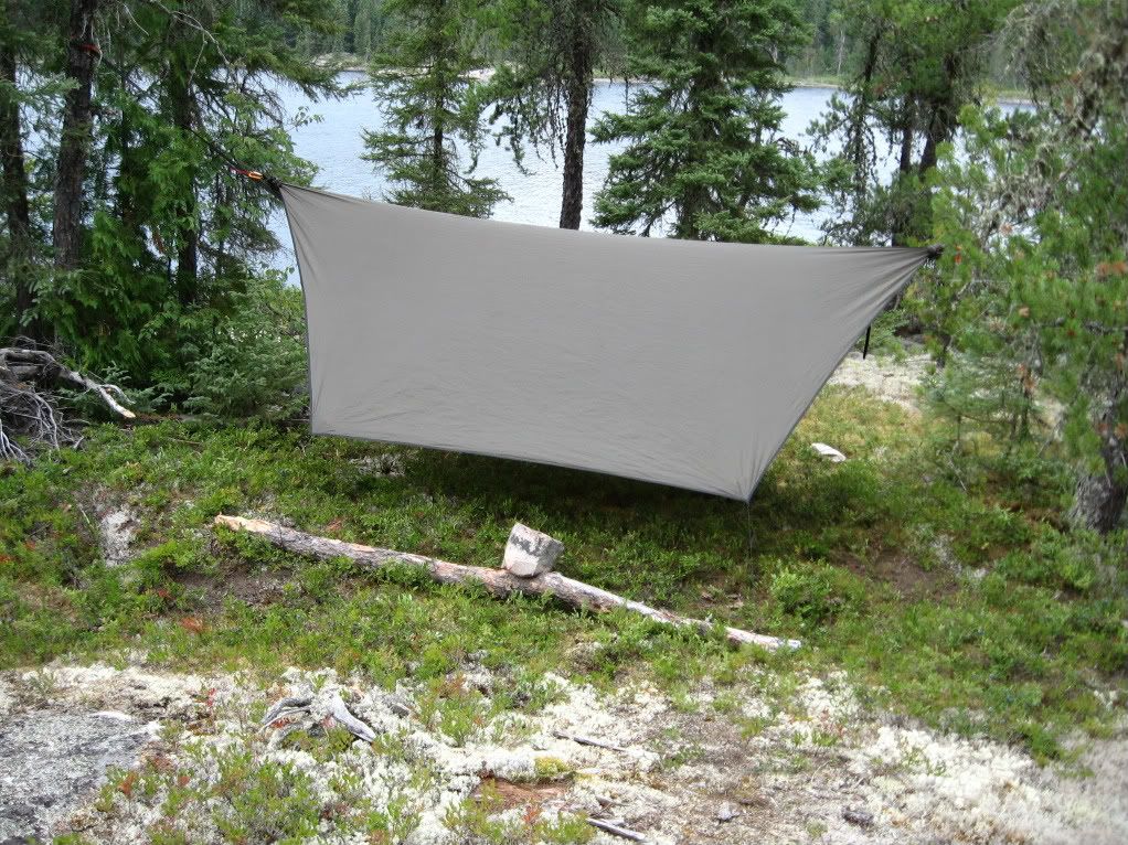
It looked like we might get some rain, so I cinched my tarp down pretty low.

We just napped the rest of the afternoon.
We broke out the everclear pretty early, mixed up some Wabakimi punch, and just kicked back.
We got half drunk and stayed that way until bed.
At dinner time we did not use any propane since that would simply violate our wilderness ethic. But we did use the fry pans to bake pizzas and to put our coffee pot on to keep it clean while we boiled water. (and we would like to thank the fly-in lodge owners for that). We ate at the picnic tables and sat on them for a fire afterward. Dave enjoyed a cigar with his drink.
During the day we saw a motor boat with three fishing folks. They waved and smiled at us as they drove by a few times. We had not seen anyone on days 1 and 2.
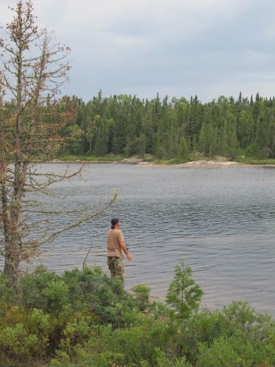
We tried fishing from shore, but got skunked.

The sun was setting a bit earlier, maybe around 9:30 or so, but still, no mossys until after were snugly ensconced in our shelter. 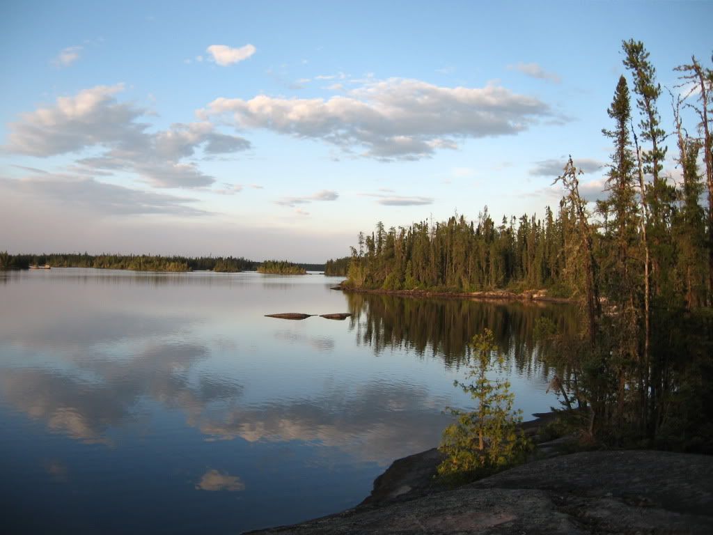
Day 4 – Super site across north end of Smoothrock to “Good” site about half way down west leg of Smoothrock.
18 km travelled
Portages: None
Camp site Night Four – Good site - 50.486893, -89.536858
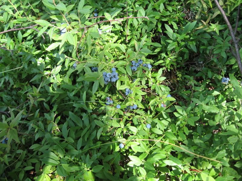
Up late again. We were in pretty good shape, distance wise. I picked a bunch of blueberries while coffee was boiling. We used the big fry pans to cook us up a big batch of blueberry pancakes for breakfast. YUM! It just doesn’t get any better than fresh blueberry pancakes and bacon on a beautiful, warm Northland morning! We ate our fill of blueberries every day. The berries were much larger up here than I recall from BW/Q, and boy were they JUICY!
We hit the water around 10am or so. Just as we got headed south, we spotted a bald eagle perched atop a tree. My little camera couldn’t get a good picture. We always feel good when we see the eagle. 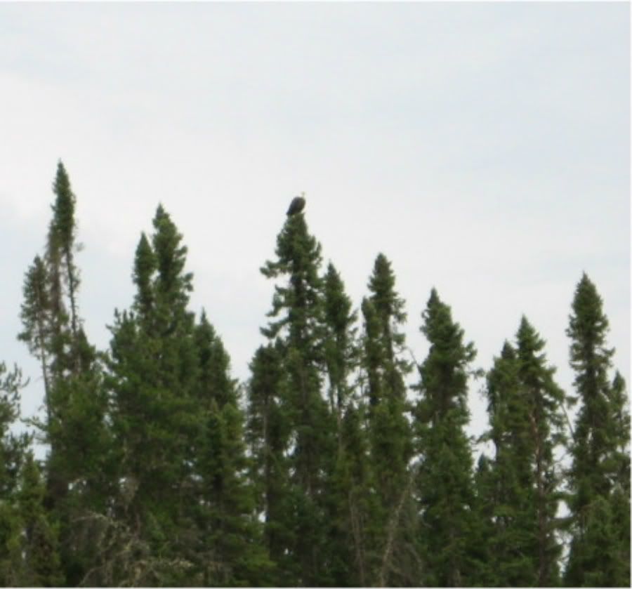
Our goal today was Spaghetti Island, near the southern end of Smoothrock.
It was overcast with what seemed to be a southeasterly wind as we paddled up to the northern crossing of Smoothrock. The wind actually was a bit of a tailwind as we went west and that helped us make pretty good time. But as we turned south on the west leg of Smoothrock a southerly wind started to blow. As the day went on the wind picked up. We were getting rain on and off as we paddled south through the canyon-like west leg of Smoothrock. By mid to late afternoon the wind was blowing right into our faces at about 20-25 mph. We finally gave up and beached the boats behind a big boulder. I got out and walked south along the shore looking for a campsite that the map said should be right there. I came down into a little slough and found a big ol’ pile of bear scat. It looked to be maybe a day or two old. Now, I was walking around, alone, in grass over my head, and I know bear were in the area. So I started to sing “Drunken Sailor” about as loud as I could. I turned around and walked swiftly back to the boats. I said to the guys those famous canoeing words, “That’s not it.” I didn’t mention the scat. I just got in the boat and pushed off.
DL and the Sargeant Major said they would paddle back north around the last point and scout for the camp site. “If we find it, we’ll blow our whistle twice.” They go off about 400m and round the point. I’m getting nervous and want to leave the bear area. I think I hear the whistle, but Sweeps isn’t so sure and he doesn’t want to backtrack and then have to paddle south again into the teeth of that wind. But I tell him, “Yeah, I’m sure that was them. Let’s go!” We found a “good” site that had northern exposure. We were maybe 4-5 km north of Spaghetti Island. The site had a firepit that was pretty well exposed. We were able to find two tent sites for Dave and Pat. 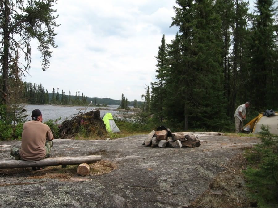
The hammocks also went up. You can see Pete’s hammock in the background below. I was feeling pretty well bushed as we finished setting our camp.
We talked it over and decided that we would get up early the next day and paddle as far and as fast as we could. As we started cocktail hour, everyone was beat down tired.
Stove Top Chicken Bowl for dinner. I got this recipe off the BWCA.com Camping Recipe thread. Thanks, MOgirl! It was hot and filling!
To bed early as we have a long day tomorrow. It was weird getting in the hammock when it was still so light out. But no mossys, again!! It looked again like we might get some rain during the night. But we got lucky and the skies cleared while we slept.
Day 5 - Bottom half of Smoothrock to Spring Lake.
13.0 km travelled (stopped paddling at 11:30 a.m.)
Portages: 1: 1200m
Camp site Night Five –Spring Lake entry - 50.373715, -89.508705 (West end Fantasia Portage)
As the morning progressed, a northerly wind picked up to about 8-10 mph. We could not have dreamed of more perfect canoeing conditions. We looked for pictographs along the way, but didn’t spot any. With that tailwind we were moving pretty fast.
We reached the end of Smoothrock by 11:30 a.m. and ate a quick lunch.
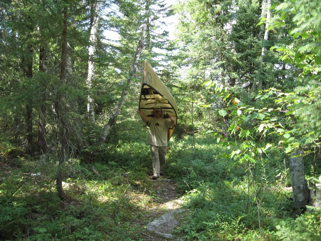
We started the 1200m portage into Spring Lake. The portage was uphill all the way for us. We had expected something like the North portage into Sunday Bay, but the trail was very nice; sandy, well-worn and very easy to walk on. I went first with a canoe and expected to stop half way. When I reached a campsite I could not believe I was at the end of the portage. I put the boat down and headed back for another load.  Here is the end of the portage, but most of the trail was like you see in the pic.
It started to rain as I walked back and it was raining steady by the time I got to the east end and picked up the last two packs. I was soaked when I finally put on my rain shell. Dave and Pat had a tarp set up by the time I reached the end of the portage again. We huddled under the tarp as the rain fell. Not a thunderstorm, just a steady rain coming down. We could tell this would last a while. We were all a bit chilled, and I started to shiver pretty hard.
I changed into my dry base layer and Pendleton. The other guys also changed into warmer clothes. Then we started a big fire, brewed some hot tea, and then had drinks for the next several hours. The fire burned nice and hot for hours.
Note how I lovingly cradle our Wabakimi Punch.
The wind was blowing from the fire into our sheltered area. We hung up the wet tee shirts and they dried out over the next several hours.
We had beef stroganoff and herb flavored pan fried bread that Dave had brought along. That bread was hot and tasty! Just what we needed! (Cache Lake brand bread. I'll be getting some of that for future trips!)
The rain stopped after about 6 hours or so, and we watched as the sky slowly cleared. It got quite cold that night, probably in to the upper 30’s. Late that night I got up to answer nature and, half-asleep, wondered who left their headlights on?? Then I remembered we were 40km from the nearest road, so I thought one of the guys had left his head lamp on. “Gonna run down the batteries,” I thought. But then I realized the light was too bright to be a headlamp. Now I was starting to wake up and I looked to see where the light was coming from. Then I realized that I was seeing the brightest, crystal-blue/white moonlight that I had ever seen in my life! The moon wasn’t even full and I could see almost like daylight! WOW!
Oh, and by the way, the lashing on Dave’s boat worked like a charm.
Day 6 – Spring Lake to Sunrise Falls
6.8 km travelled
Portages: 6: 105m, 30m, 40m, 51m, 191m, 70m
Camp site Night Six – Sunrise Falls - 50. 336038, -89.558315
I got up very early today to a clear azure sky. It was just plain cold. I put on my Pendelton over my long johns and was still a bit chilly. I started the water to boil while the other guys were still in the sack. They all got up once the water was ready for tea and coffee. All the guys were talking about that moon last night. It was so bright and clear!
We have several portages today. We will paddle up the Lookout River from Spring Lake toward Sunrise Falls. We were camped right at the beginning of Spring Lake. The water was so low that barely any water was flowing from Spring Lake down into Smoothrock. Where the rapids should have been was just a rock wash with a very shallow, lazy creek. You can see the rocks poking over the surface in the photo.
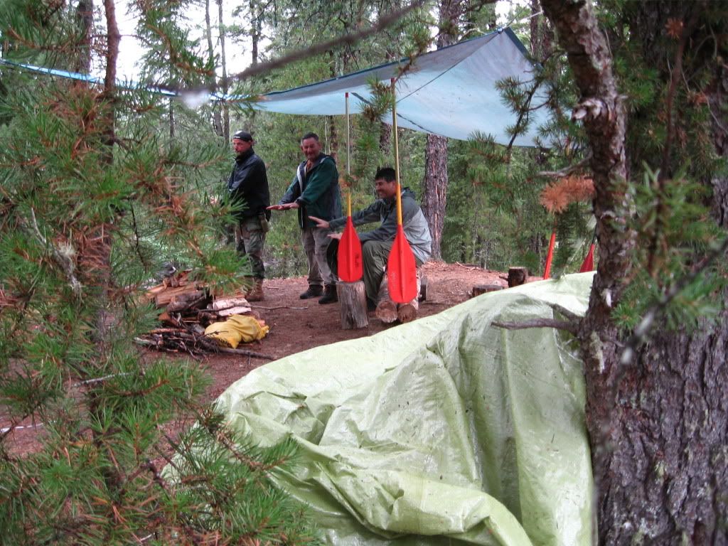
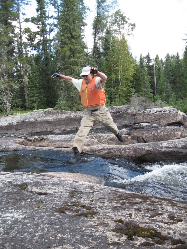
When we were ready to launch, we had to figure a way to get around the long muddy stretch which used to be the entry way from the portage. We were able to get the boats loaded at a spot where the rocks are about 4 feet high, but it let us get into water and not mud. We paddled through some pretty shallow, rocky stuff before we were out into the lake itself. From there it was a string of short portages around the various rapids of the Lookout River until we came to the Walleye Kitchen. We completed the first 4 portages by 11 or so and we stopped to play at the last falls. It was a warm, sunny day and we just couldn’t resist.
Oh, yeah…the Flying Moose is loose!
Burt at Wildwaters had told us that we should expect to meet another party of six coming in from Wabakimi Lake and exiting at Schultz’s Trail with us. We passed the other group at the Walleye Kitchen. They were camped there and were catching a lot of fish. They politely cleared the way for us and showed us where the portage went. We hauled our stuff through the site and on over to the other side. This is one of the roughest portages we saw on this trip. It is rocky, narrow, and treacherous. We had lunch at the west end of the portage and eyed a campsite just over the water from the portage. We decided to head for Sunrise Falls and camp there. The map indicates that fishing is good there and it isn’t very far. We didn’t want to spend too much time on the water today as we needed to dry out all the stuff that got wet in yesterday’s rain.
We reached the Falls in an hour or so.
 |
| Sunrise Falls |
We took everything out; all our clothes, tents, hammocks, sleeping bags, ropes, gear, packs, tarps…everything. We spread it all in the sun and then Sweeps and I went for a swim. The wind was blowing gently and the sun was shining bright. We were all dried out and refreshed in just a few hours.
The campsite is nice and grassy. It hasn’t seen much use recently and the grass is over two feet tall. The fire pit has only some very old residue, but we can tell this fire pit has been here for many years.
Sargeant Major, SIR, YES, SIR! caught a walleye (about 20” and around 2.5lbs) in the pool just beneath Sunrise Falls. He also caught a trout, but as Dave was trying to string it, that old boy gave it one last effort and jumped back into the water. No problem, we still had that walleye. OH YEAH! Fish for dinner tonight! We decide to use the pan fried bread mix to batter up the fish and Dave and I start to set up the kitchen. We have cocktails ready.
Pat comes back into camp looking dejected. Pat had finished fishing and as he was admiring the fish on the chain, it flopped and struggled. Somehow it unhooked the spring link and got itself up off the chain and, you guessed it, got away!
 Lost both fish. Mac N Cheese for dinner.
Also, we had a few raspberries that were still ripe and growing in a little patch just behind the campsite. Tasty!
I could not find a safe place to hang my hammock, so I bunked with Dave in his tent. DL has a nice single wall free-standing tent. It’s plenty roomy for two with large vestibules on each side. But I had gotten used to the comfort of the hammock and when I laid down, the pine cones under me were real pain.
We had another bright moon, but it was not so cold. I was up around midnight and watched the moon rise over the water. What a sight!
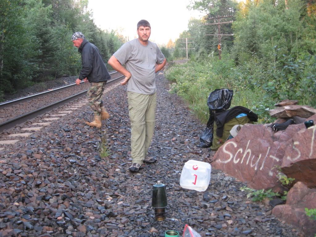
Day 7 – Sunrise Falls to Schultz’s Trail
9.0 km travelled
Portages: 1: 175m
Camp site Night Seven – Schultz’s Trail - 50.286488, -89.525185
We knew we did not have far to go today, so we had a late morning. I was just about to get up early when it started to rain. I felt really down and hoped we would not have to wake in a rainstorm and pack up wet. But, it was just a short drizzle, and Pat got up immediately after it stopped. He put the water to boil and we all got up to hot drinks. I was stiff as we had our morning caffeine. We leisurely packed up, letting the sun dry our tarps a bit before packing them.

We got in the water around mid-morning. We had one portage into Onamakawash and then we had to find a way through the rocks. The water was so low we almost had to get out and drag the boats over, but we squeaked through a little opening maybe 18 inches wide and paddled on.
We had a good tailwind as we paddled southeast toward the take out point. We finished paddling around 1:30 or so. It had been bright and sunny when we started, but a cloud bank was blowing in as we set up camp. There is no actual campsite here, just some very uneven and rocky grassy areas around a couple of shuttered old cabins.
We battened everything down and set up a lean-to on one of the cabins because a big thunder head was rolling right at us. We thought we were going to get it for sure.
But we only got a few light sprinkles as the storm passed us just to the northwest. Sarge, Sweeps, and I all went for a swim as the sun was back out. After a small lunch of pope’s nose and crackers, we went and explored the train tracks.  Pete went and looked at the trestle and reported it looked every bit as dangerous as Burt had said. If you get caught out there when a train is coming you are dead. There is just no room to get off the tracks.
At around 4, the other party came paddling down the lake. They, too, had escaped the worst of the storm. We got to talking and it turns out they are the folks who own Northwest Canoe in the Twin Cities. Well, that was fortuitous since dl was going to need some repairs on the MNII. They have some very nice gear and weare paddling a beautiful cedar strip. What a nice boat!
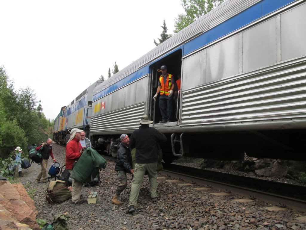
Here is a photo of it going into the train.
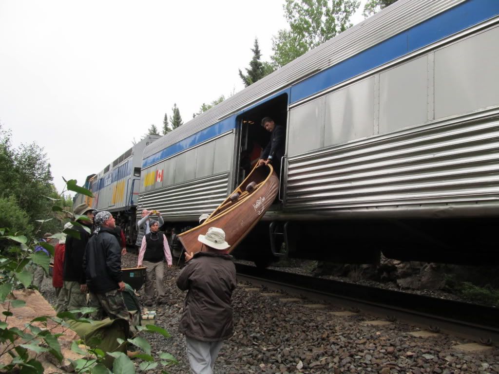
We decided that we would carry as much as we could up to the tracks today and then just have a couple small packs to haul up in the morning.
We had a huge dinner of Chili Mac, cheese sandwiches, sausage, and pan fried bread. Our stomachs were swollen and we felt great as we relaxed with our after dinner drinks.
Again, I could not find a good spot for my hammock and slept in Dave’s tent. Ouch.
But, the weather was beautiful, again. And again, no mossys until we were in our shelter. We got maybe five skeeter bites between the four of us all week! We got more bites just bringing our stuff up to the tracks than we had all the other days of the trip. And we used almost no bug dope at all!
We decided that Pat would set his alarm for six so we could get up and be at the train early, as we had been warned to do by Burt and Brenda. So, with the gear mostly up at the tracks and the alarm set, we went to bed just after sunset. Someone somewhere was playing guitar. It must have been someone in one of the cabins which were clustered around the end of the lake. We could just hear the strumming as we drifted off to sleep…
Day 8 – The train… the border and then on to Duluth.
We awoke at six, to a beautiful sunny sky. We packed up our last few things and went up to the tracks, just in case the train was early. We had the trusty old Svea up there and put a pot on to boil. We decided to just have coffee because the train would be here in an hour or so.

But we were in good spirits and were not going to let a little fog dampen them.
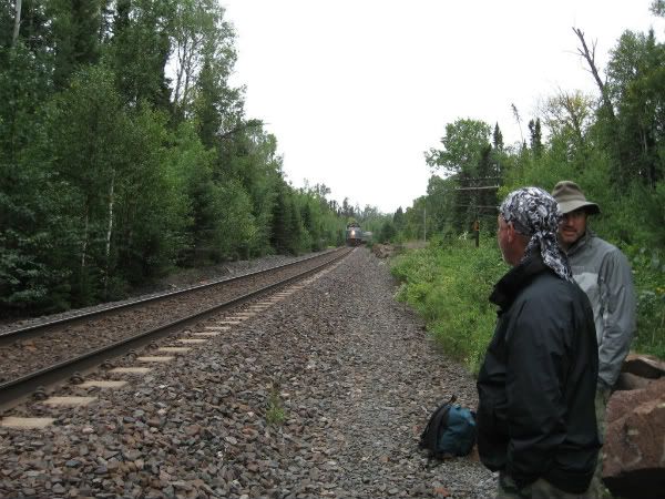 At around 9:30 the woman who lives in the next cabin came up with her pack and we asked how did she know the train was going to be late. Does she have a radio in her cabin that allows her to speak with the train crew?? She looked at us weirdly and said the train’s not late… it’s only 8:30. What?? “Oh,” she said, “When you landed yesterday you entered the Central time zone.” You could have knocked us over with a feather! Who’d a thunk it? Well, no wonder we were waiting so long! Anyway, the train finally did arrive at little after 10:15 CDT [any time references from here on are in CENTRAL TIME!!!]
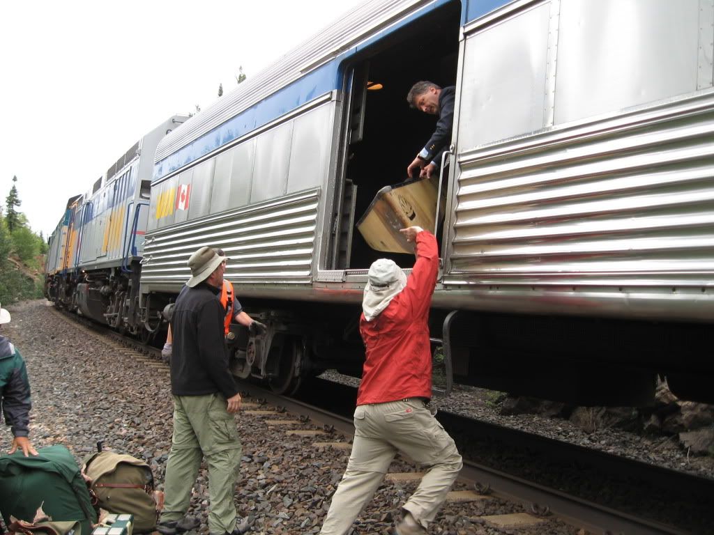
then we were directed to the bubble car 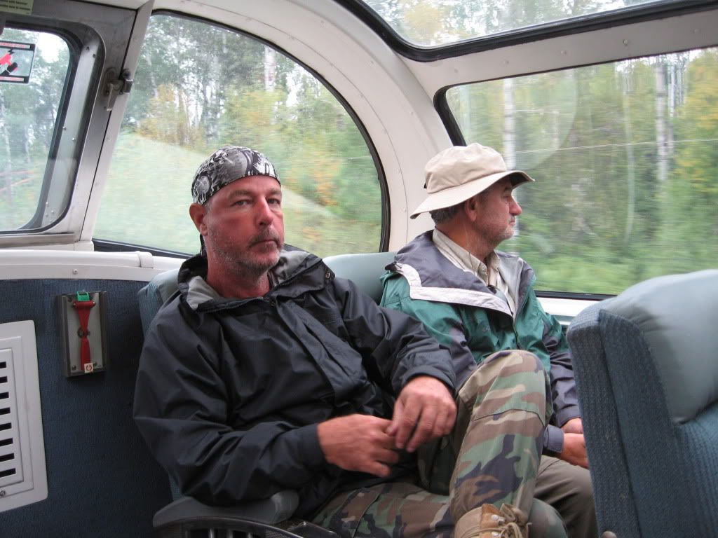 and off we went to Armstrong.
and off we went to Armstrong. 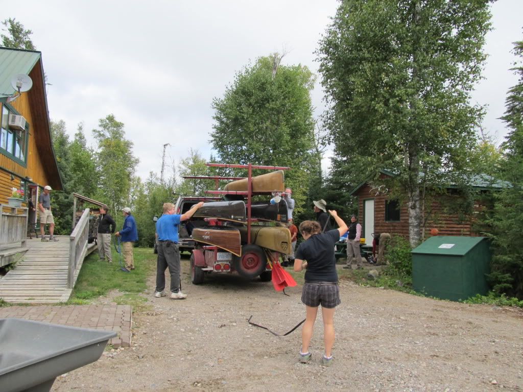 Rebecca was waiting at the station and we lashed down the
 canoes and drove back to Wildwaters.
A quick hot shower and off we went. We passed dl just as we exited the drive onto the road. Sweeps punched it and we thought dl would be long behind us, what with a canoe strapped on and all. But he hauled a** and caught up to us. We were driving like a couple old moonshiners flying down a country road! We made it to Thunder Bay in about 2.5 hours and waved so long to Dave as we pulled into a burger joint.
When we got to the border, we answered all the questions of the border guard. He was about 28 or 30, and asked us about how was the fishing, did you catch anything? Do you have any fish in the car? We told him the whole story about catching the trout and the walleye and how they got away. He looked at us for a second, and then said, “I gotta look in the back. Open her up!” Clearly, he did not believe that cock and bull story, and thought we were trying to sneak some fish back into the U.S. I mean, how could you possibly NOT catch fish in Wabakimi? He opened the back, took a sniff, closed it, came back to driver window, looked in and said, “Soooo, I guess you guys really aren’t fisherman, eh?” We lost it. We were laughing so hard we nearly busted an atery. “So, welcome home, then,” he says and sends us on our way.
As we were driving toward Grand Marais, who do we see right in front of us? Dave! So we raced each other south all the way to Duluth, where we peeled off to go west down to Mille Lac and Dave went east toward home.
........................................................................
Epilogue – Pete’s Cabin
We drove down and spent the night with my cousin, Pete, at his cabin down in the Iron Range.
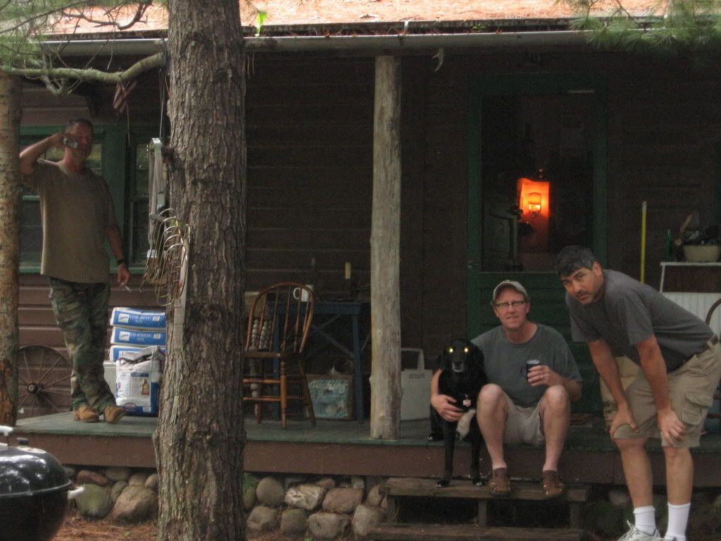
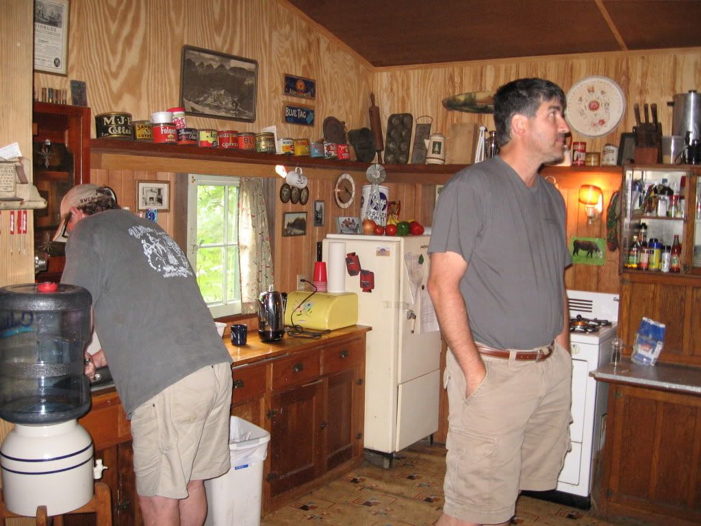
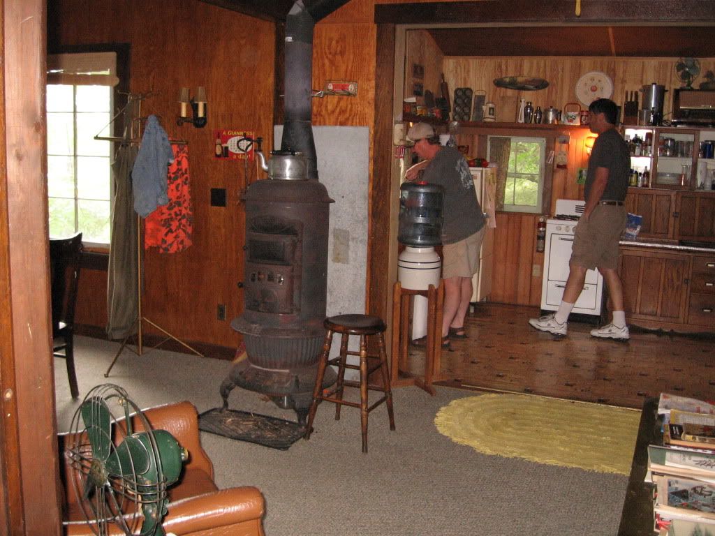
And that’s all I have to say about that.
One more thing checked off the bucket list.
Unfortunately, the video is blocked in my country. This is odd as we're both in the same country. Maybe it's because I'm in Indiana. :)
ReplyDeleteHey, Rob -- Yeah, my buddy made the video, but included music that Utoob says is copyrighted. The video should play, but without sound.
ReplyDeleteJust saw the thread on BWCA.com again and clicked over here. It won't play at all. Says there is content from SME that has been blocked in my country. The write up was great though.
ReplyDelete